

![[Company Logo Image]](images/sphere_smooth.gif)
WinDisp is a self-contained package designed to accept a wide variety of data formats an integrate them into a coherent presentation which can be printed or exported to a variety of standard format for use in other programs.
- Arbitrary ASCII column/delimited data files
- Geosoft line format
- Geosoft IP *.dat data format
- Zonge IP *.avg data format
- AMIRA EM format
- Located and assay/collar/survey drillhole files
- DXF and ArcView Shape files
- Geosoft binary and gxf (not compressed binary)
- Ermapper
- ARCinfo
- BIL/BIP/BMP
- PCI
- Geopak
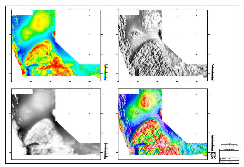
- Colour/greyscale/colour drape
- Realtime and colour sun-illumination
- Banded colour
- RGB
- Simple merge
- Contour generation
- Convolution and FFT filtering
- Clipping, resampling and rotation
- Marker/Value
- Profile
- Pseudosection
- Sector/Circle/Bar
- Vector/phase/spectral
- Gridding of point data
- Smoothing/vertical gradient of profile data
- Clipping/masking of data points to polygons
- Two-point coordinate transformation and scaling
- Geographic coordinate transformation
- Up to 16 data macro definitions
- Export of data to csv formatted file
- Standard windows printer
- ArcView/MapInfo
- Enhanced Metafile
- DXF
- BMP/JPEG
- PostScript/HPGL2
The following two documents contain more detail on what WinDisp can do: