![[Company Logo Image]](../images/sphere_smooth.gif)
|
|
|
|
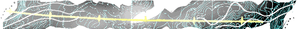
WinDisp Export MenuDisplay as DXFOnce a layout has been displayed the graphics in the display can be exported as a DXF file for use in other applications. All graphics in the display are exported except for any displayed images. The DXF file uses the same coordinates as used in the map display. Display As MapInfoOnce a layout has been displayed the graphics in the display can be exported for use in MapInfo. When this option is used, the line graphics in the display are exported as a DXF file and any images are exported as a georeferenced BMP file. If there are multiple images, the user is given the option of exporting a merged image or multiple individual images. Display As JPEGOnce a layout has been displayed the graphics in the display can be exported as a JPEG file for use in other applications. A world file is also generated so that the JPEG file can be georeferenced with the same coordinates as used in the map display. Display As ShapeOnce a layout has been displayed the graphics in the display can be exported as an ESRI Shape file for use in ArcView or MapInfo. This shape file is georeferenced with the same coordinates as used in the map display. Any images included in the display are exported as georeferenced BMP files. If there are multiple images, the user is given the option of exporting a merged image or multiple individual images. Display As MetafileOnce a layout has been displayed the graphics in the display can be exported as an enhanced Windows metafile. This metafile can then be imported into other applications and edited as required. In addition a WinDisp specific world file is created so that the metafile can be used in multi-panel displays. Contours As ShapeOnce a contour file is set up to display correctly at a given map scale, the contours can be exported to a shape file which can then be displayed as a separate theme within ArcView. This shape file is georeferenced with the same coordinates as used in the map display and each contour line has the contour level attached as the line attribute. DXF as ShapeOnce a DXF file is set up to display correctly, the polyline components of the drawing can be exported to a shape file which can then be displayed as a separate theme within ArcView. This shape file is georeferenced with the same coordinates as used in the map display and each polyline has the dxf layer name attached as the line attribute. |
|
Send mail to
john.paine@onaustralia.com.au with
questions or comments about this web site.
|